🎬 The Trip Vlog — watch the full film
Guthega to the Main Range and back · 12 min · shot 29–30 Aug 2026
Live Weather — Guthega (1,590 m)
Auto-refreshes every 10 min while you have reception
Loading trail map...
Waypoints (tap to view on map)
Trip Story — How It Went
29–30 Aug 2026An overnight snow-camping loop from Guthega, across the Illawong Suspension Bridge and up into the Main Range high country.
We left the Guthega car park just before 1 pm on Saturday and followed the Snowy River traverse to the Illawong Suspension Bridge, crossing at 2:08 pm. From the lodge the marked track ends — we pushed on west into the snow, climbing through the afternoon to nearly 2,000 m below Little Twynam, and pitched camp at 5 pm on a shelf at 1,920 m. After sunrise over the valley we packed up, dropped back down for a morning break above the river, recrossed the bridge at 9:07 am and were back at the car by 10:09 am — 11.2 km all up, about 21 hours car to car.
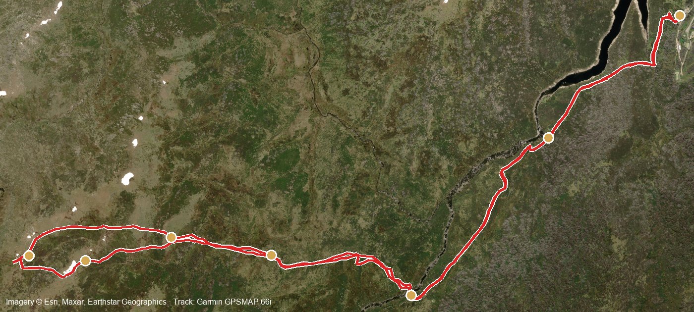
The full recorded route — gold dots are the timeline stops below
- Sat 12:50 pm · 1,624 m
Setting Off — Guthega Car Park
Packs on at the trailhead. The Garmin started recording at 12:50 pm and tracked every step from here.
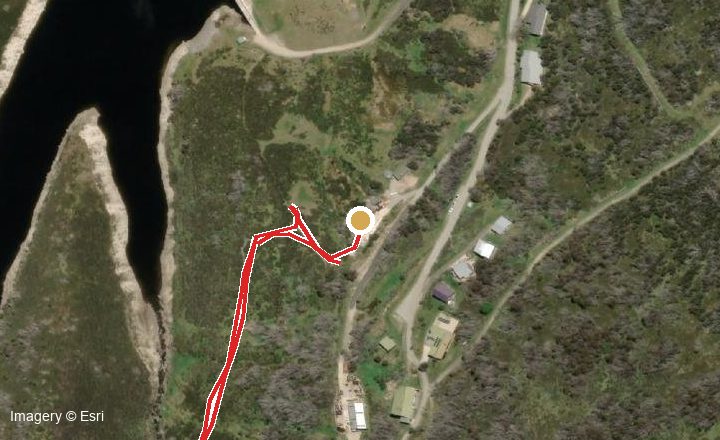
Where we were — gold dot on the recorded track - Sat 1:15 – 2:40 pm
Snowy River Traverse & Suspension Bridge
Along the benched track above the Snowy River, then one at a time across the icy mesh of the Illawong Suspension Bridge at 2:08 pm.
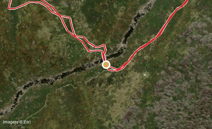
Where we were — gold dot on the recorded track - Sat 3:03 pm · 1,699 m
Illawong Lodge — Into the Snow
Past the historic lodge, where the marked track ends. From here it was off-track alpine country and proper snow.
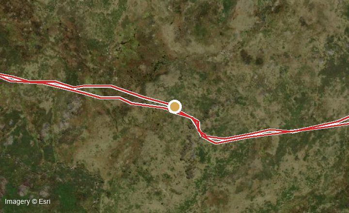
Where we were — gold dot on the recorded track - Sat 3:20 – 4:50 pm · up to 1,993 m
The Climb — High Country
The big push west below Little Twynam — the Garmin marked our high point at 1,993 m at 3:38 pm, with the Main Range opening up around us.
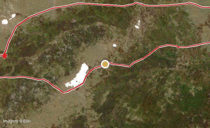
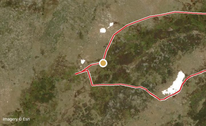
Where we were — gold dot on the recorded track - Sat 5:09 pm → Sun 7:40 am
Camp at 1,920 m
Tent pitched on a snow shelf just after 5 pm — a dozen waypoints marked around camp. Dinner as the light went, a cold night, then sunrise over the Snowy valley from the tent door.
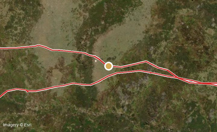
Where we were — gold dot on the recorded track - Sun 7:40 – 8:50 am
Morning Break & the Descent
Packed up and dropped off the shelf, pausing at 8:28 am for a break at 1,785 m looking back at where we camped.
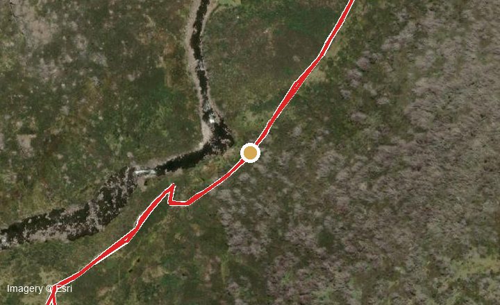
Where we were — gold dot on the recorded track - Sun 9:07 – 10:09 am
Bridge Again & the Home Stretch
Recrossed the suspension bridge at 9:07 am and cruised the river traverse home — back at the Guthega car park at 10:09 am.
Where we were — gold dot on the recorded track
Trip Media Repository
Originals are stored untouched in full quality and can be downloaded individually. Everything is tagged to whoever uploads it.
Drag & drop photos, videos or GPS files here
or click to browse · multiple files welcome · no size limit · big videos upload in resumable 30 MB chunks
The Route, Step by Step
- Guthega car park (1,640 m). Start at the western end of the car park at Guthega village. The signposted Snowies Alpine Walk / Illawong track drops towards the Snowy River. In winter the first section is often the iciest — put snowshoes on early rather than late.
- Guthega footbridge (~300 m in). Cross the small metal footbridge below the village, then follow the benched track south-west along the true left (east) side of the Snowy River valley through snow gums and alpine heath.
- Snowy River traverse (1–3 km). The track undulates above the river with a couple of steady climbs (~250 m of total up-and-down for the day). Several small side creeks cross the track — in snow these can hide under fragile snow bridges, so probe before stepping. Views open up to Mt Twynam and the Main Range on your right.
- Illawong junction (3.4 km). The Snowies Alpine Walk continues left towards Charlotte Pass via the Spencers Creek suspension bridge. Turn right onto the short Illawong Bridge Track spur.
- Illawong Suspension Bridge. The historic swing bridge crosses the infant Snowy River. It moves underfoot and ices up — cross one person at a time, holding the cables, snowshoes off if they don't grip the mesh.
- Illawong Lodge (3.6 km, 1,590 m). A short climb up the west bank reaches the lodge on the edge of the snow country. This is the end of the marked track and the standard turnaround. The lodge is a private, locked club lodge — it is not a public shelter except in a genuine emergency.
- Beyond the lodge (off-track). West of Illawong is trackless alpine backcountry rising towards Little Twynam and Mt Twynam. Only continue with navigation skills, avalanche awareness, and a firm turnaround time. Return the way you came — use TracBack on the GPS if visibility drops.
What to Watch Out For
Weather that turns in minutes. Above 1,500 m, blue sky can become blizzard, fog, or freezing rain within an hour. Check the BoM alpine forecast the morning you leave, and turn back the moment cloud drops onto the track — whiteout navigation along the river corridor is disorienting even with a GPS.
Hypothermia and wind chill. The most common serious incident in the Snowies. Wind chill regularly drives effective temperatures below −10 °C. Layer up before you get cold, swap wet gloves and socks immediately, eat and drink regularly, and watch each other for stumbling, slurring, or unusual quietness — the “umbles” are the first signs.
The suspension bridge. Icy mesh decking, moves underfoot, one person at a time. Keep gloves on and hold the hand cables. Never attempt to cross the Snowy River anywhere else — snow bridges over the river collapse without warning and the water beneath is fast and frigid.
Hidden creek crossings. Side creeks along the traverse hide under snow. A leg through a snow bridge into running water is an instant hypothermia risk — probe with poles where the snow sags or you can hear water.
Avalanche terrain (beyond the lodge). The walk itself stays in gentle terrain, but the eastern faces of Twynam and the slopes above the west bank can slide after heavy snowfall or wind-loading. If you're pushing past Illawong into steeper country, treat it as avalanche terrain: check recent snow history, avoid loaded lee slopes and cornices, and don't travel directly above or below each other.
Icy early-morning track. Overnight refreeze turns yesterday's soft snow into boilerplate. Microspikes or snowshoes with heel crampons make the morning leg far safer than bare boots.
Short winter days. In August/September, usable daylight ends around 5:30 pm. Be walking by 9 am, set a hard turnaround time of 1–2 pm for anything beyond the lodge, and carry a headtorch regardless.
Alpine sun. Snow reflects UV from below — you can burn in under 30 minutes even in cloud, and snow blindness is real. Category-4 sunglasses and SPF 50+ on every exposed surface, including under your chin and nostrils.
In an Emergency
1. Stop and stabilise. Get the injured or hypothermic person out of the wind (emergency shelter or behind rocks/trees), insulated from the snow, into dry layers, with warm sweet drinks if conscious.
2. Call for help with a location. Mobile coverage on this walk is patchy to none — assume the inReach is your lifeline. If using a phone, try 112 even with no bars of your own carrier, and read out the grid coordinates from your GPS (the app's waypoints show lat/long). The Emergency+ app reads your coordinates aloud for you.
3. Shelter in place unless unsafe. A stationary party at a known location is found quickly; a moving one is not. The exception: genuine life-threat at your location (rising storm, avalanche runout). Illawong Lodge may be used as an emergency refuge if lives are at risk.
4. If someone is overdue. Your trusted contact should call 000 and report the trip intentions details if you haven't checked in by your agreed late-back time. Lodge a NPWS trip intention form tonight and set your Garmin MapShare so they can watch your live track.
Garmin GPSMAP 66i Field Guide
Written for this walk, checked against Garmin's official 66i manual. The track and waypoints on this page are already loaded on the device as illawong-walk.gpx.
The 66i is fully button-driven (no touchscreen — which is why it works with gloves). The keypad sits below the screen, with the four-way rocker in the middle:
- FIND — opens the search menu. This is your “navigate somewhere” button: tracks, waypoints, coordinates all live behind it.
- MARK — saves your current position as a waypoint, instantly. The most important button of the day if you leave the track.
- QUIT — cancel / go back one screen.
- PAGE — cycles through the main pages (Map → Compass → Trip Computer → Altimeter…).
- ENTER — select / confirm. On the Map or Compass page it also opens the activity recording controls.
- MENU — options for the current page. Press it twice from anywhere to open the Main Menu — remember that one.
- ▲▼◀▶ — the rocker: move through menus and pan the map cursor.
- IN / OUT — zoom the map in and out.
- ⏻ — power key (side of the unit): hold to turn on/off, short-press for the status page and backlight brightness.
- SOS — under the protective cap on the side of the unit. Covered in the emergency section below — don't test it!
Tip: lock the keys when it's in your pack strap — short-press the power key, then Lock Keys. Any key wakes the backlight.
Animals & Plants to Look For
In winter the valley is quieter but far from empty. Wombats stay active all winter — look for their cube-shaped droppings and deep trenched paths through the snow, especially near the river flats. Crimson rosellas and gang-gang cockatoos (listen for the creaky-door call) feed in the snow gums, and little ravens and flame robins work the clearings. Echidnas are mostly torpid in the cold months but occasionally trundle across the track on mild days.
The boulder fields of the Main Range west of the lodge are habitat for the critically endangered mountain pygmy-possum — you almost certainly won't see one, but it's a good reason to keep to the track and never leave food scraps. You may also see brumbies (wild horses) in the valley — keep your distance and never approach or feed them.
Snakes are not a winter concern — alpine copperheads and white-lipped snakes are dormant under snow. From November to April, watch where you step near the river and in sun-warmed heath.
Flora: the walk winds through snow gum woodland (the twisted, colour-streaked trunks are at their best against snow) and alpine heath. In summer the same track is lined with billy buttons, alpine mint-bush, yam daisies and snow daisies — worth a return trip in January. Everything in the park is protected: no picking, and no firewood collection.
A Bit of History
These mountains are the Country of the Wiradjuri, Wolgalu, Ngunnawal and Monaro Ngarigo peoples, who travelled here in summer for millennia for bogong moth feasts, trade and ceremony.
Illawong Lodge began as Pounds Creek Hut in the mid-1920s, built for early Kosciuszko surveying and hydro-electric investigation work, and is one of the oldest buildings still standing in the park. Since the 1950s it has been maintained by the Illawong Ski Tourers as a private club lodge, and the suspension bridge was built so skiers could reach it safely across the Snowy — the current bridge is a rebuilt version of the original swing bridge. Guthega itself grew from the Snowy Scheme: Guthega Dam and power station (1955) were the Scheme's first completed project.
Getting There & Parking
- From Jindabyne take Kosciuszko Road towards Perisher, then turn onto Guthega Road. Sealed to the power station, then ~6.5 km of unsealed road to Guthega village (about 45 min from Jindabyne).
- Snow chains are mandatory for 2WD vehicles June–October on Kosciuszko and Guthega Roads — carry and know how to fit them. AWD/4WD exempt but should still carry them.
- Park on Main Road near the trailhead at the village. Arrive early on weekends and in the ski season — parking is limited.
- Kosciuszko NP vehicle entry fees apply (higher in the winter season) — buy a day pass online or at Jindabyne before driving up.
- No toilets or water at the trailhead — last facilities at Jindabyne or Perisher.
- Check road conditions on the Live Traffic NSW app the morning you drive up.
Packing Checklist
Ticks are saved on this device — run through it again at the car before you drive off.
Camp0/5
Cooking & Water0/9
Clothing0/6
Safety & Navigation0/6
Toiletries0/4
Don't Forget (not on your list!)0/10
Check Before You Go
Take the Track With You
Download the GPX (full track + 5 waypoints) and copy it to your GPS — on a Garmin, drop it into the Garmin/GPX folder and it appears under Saved Tracks.
Download GPXTrack geometry © OpenStreetMap contributors (ODbL). Distances GPS-measured on the current Snowies Alpine Walk alignment. This page is a planning aid, not a substitute for a topographic map, current NPWS advice, or alpine experience.